


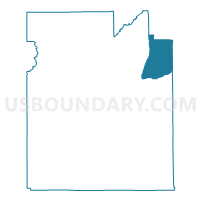
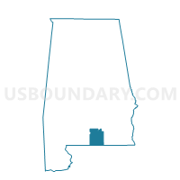
Valley Grove-Friendship, Covington County, Alabama
About
Outline

Summary
| Unique Area Identifier | 521558 |
| Name | Valley Grove-Friendship |
| County | Covington County |
| State | Alabama |
| Area (square miles) | 39.86 |
| Land Area (square miles) | 39.72 |
| Water Area (square miles) | 0.14 |
| % of Land Area | 99.65 |
| % of Water Area | 0.35 |
| Latitude of the Internal Point | 31.38357410 |
| Longtitude of the Internal Point | -86.24360350 |
Maps

Graphs
Select a template below for downloading or customizing gragh for Valley Grove-Friendship, Covington County, Alabama


Neighbors
Neighoring Voting District (by Name) Neighboring Voting District on the Map
- Babbie-Cedar Grove, Covington County, AL
- Danley's Cross Roads, Coffee County, AL
- Opp, Covington County, AL
- Weeds Store, Crenshaw County, AL
- Wiggins Store, Covington County, AL
Top 10 Neighboring County Subdivision (by Population) Neighboring County Subdivision on the Map
- Andalusia CCD, Covington County, AL (18,495)
- Opp CCD, Covington County, AL (9,607)
- Elba CCD, Coffee County, AL (6,710)
- Rose Hill-Gantt CCD, Covington County, AL (4,133)
- Brantley CCD, Crenshaw County, AL (3,089)
Top 10 Neighboring Place (by Population) Neighboring Place on the Map
Top 10 Neighboring Unified School District (by Population) Neighboring Unified School District on the Map
- Covington County School District, AL (22,091)
- Coffee County School District, AL (18,627)
- Crenshaw County School District, AL (13,906)
- Opp City School District, AL (6,659)
- Elba City School District, AL (5,178)
Top 10 Neighboring State Legislative District Lower Chamber (by Population) Neighboring State Legislative District Lower Chamber on the Map
- State House District 91, AL (49,948)
- State House District 92, AL (40,506)
- State House District 90, AL (39,991)
Top 10 Neighboring State Legislative District Upper Chamber (by Population) Neighboring State Legislative District Upper Chamber on the Map
Top 10 Neighboring 111th Congressional District (by Population) Neighboring 111th Congressional District on the Map
Top 10 Neighboring Census Tract (by Population) Neighboring Census Tract on the Map
- Census Tract 105, Coffee County, AL (4,558)
- Census Tract 9616, Covington County, AL (4,133)
- Census Tract 9623, Covington County, AL (3,279)
- Census Tract 9624, Covington County, AL (3,144)
- Census Tract 9639, Crenshaw County, AL (1,408)